home
Michael Commons "Carriboo Claims"
Claims for sale: whole or part.
Location: Southeastern Idaho
Accessibility: 4-wheel drive, one hour from airport with jet service.
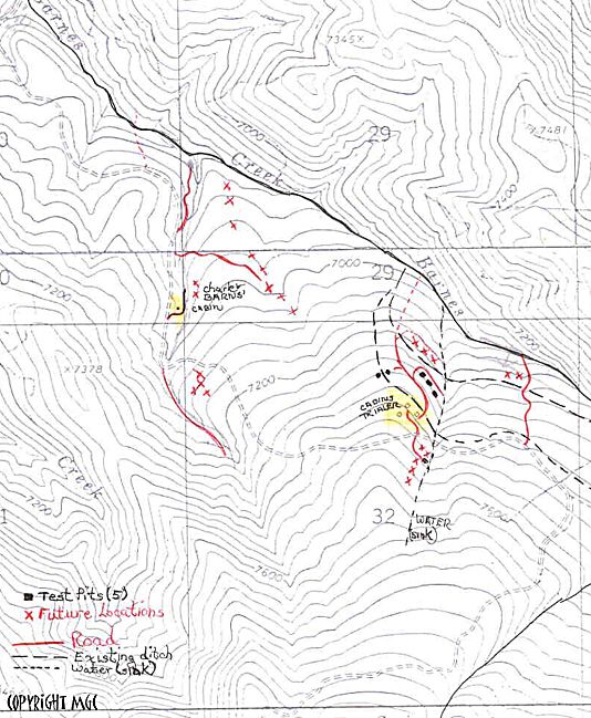
Size: 800 acres contiguous in 5 solely owned claims.
Current Mining Activity: exploratory and recreational.
Other features: roads already present, functioning ditch system for gravity-fed water supply to the
claims area.
CONTACT
Michael Commons
E-mail: cariboo2002@msn.com
No, that's not a misspelling of "Carriboo", which was the official spelling in the late 1800's
when this area experienced an early mining "boom". Although the boom towns are long gone, the area continues
to see strong interest from recreational miners, and may again be commercially minable using modern industrial
processes and heavy equipment.
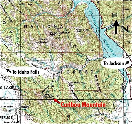
Although located in a remote area of Southeastern Idaho, it is only an hour's drive
from Jackson Hole, Wyoming, and an airport with jet service. A second airport is only two hours' drive to Idaho
Falls.
|
 |
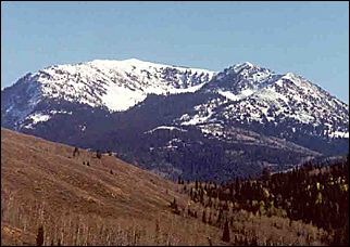
Caribou Mountain in Southeastern Idaho
|
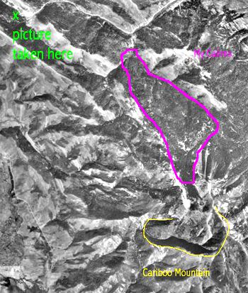 An aerial photo of the claims is shown to the right. The approximate claims area is outlined in purple.
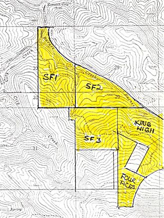 To the right is a topography map outlining the general boarders of the Commons claims. The claims are
titled and numbered (in Idaho) as follows.
To the right is a topography map outlining the general boarders of the Commons claims. The claims are
titled and numbered (in Idaho) as follows.